Featherbrook Neighbourhood Guide
Featherbrook is a practical Point Cook neighbourhood for people who want everyday shops, community facilities and open space close to home. Its appeal comes from how these features fit together. Many daily needs sit around Featherbrook Shopping Centre, Featherbrook Community Centre, Boardwalk Boulevard and Sneydes Road. Longer trips still require planning, especially when traffic builds or a household depends on Rail transport.
This Featherbrook neighbourhood guide explains the area as a place to live rather than as a list of nearby businesses. It looks at street layout, housing, local movement, services and the trade-offs residents should check before choosing a home.
Where does Featherbrook sit within Point Cook?
Featherbrook is a Residential area in Point Cook, in Melbourne’s south-west. It forms part of a wider growth corridor shaped by newer estates, major roads and expanding local services. Its identity is tied more closely to Point Cook than to a separate town centre.
The neighbourhood is organised around local roads that connect homes with shops, parks and community facilities. Boardwalk Boulevard provides an important route through this part of Point Cook. Sneydes Road helps connect the area with destinations beyond the immediate neighbourhood, including routes towards the Princes Freeway.
That position gives Featherbrook two useful scales. A resident can handle a small daily task within the neighbourhood, then use larger roads for work, study or services elsewhere. The second part can take much longer during busy periods, so a map distance alone gives an incomplete picture.
People comparing suburbs sometimes treat every named Housing estate as a sealed pocket. Featherbrook does not work that way in daily life. Residents move across nearby parts of Point Cook for schools, sport, food, health services and social visits. It makes more sense to assess Featherbrook as a local base within a connected suburb.
What does the neighbourhood feel like on an ordinary day?
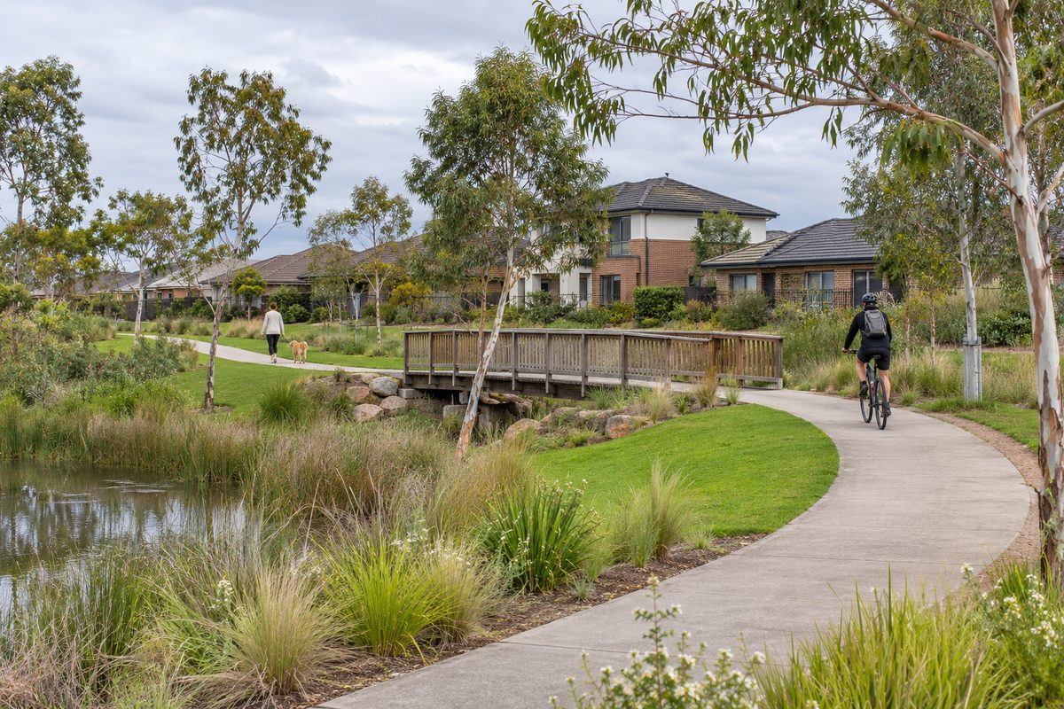
Featherbrook has the planned form common to newer parts of Melbourne’s west. The streets contain modern detached homes, smaller lots in some pockets, footpaths and landscaped public areas. The result can feel orderly, but conditions change from one street to the next.
Homes near local activity points may offer a shorter walk to shops or facilities. They may also receive more passing traffic, delivery noise or parking pressure. Quieter internal streets can reduce through traffic, yet add time to every drive. Buyers and renters should test that trade-off in person.
A useful inspection covers more than the property boundary. Walk the nearest route to the shops. Check whether intersections feel easy to cross. Look at shade, lighting and footpath continuity. Notice how many cars line the street after work. These details shape daily life more than an estate map does.
Weather also changes how the area works. An easy ten-minute walk on a mild morning may feel very different in strong wind, summer heat or heavy rain. Families using a pram, scooter or mobility aid should assess the actual route rather than relying on a straight-line distance.
What kinds of homes are found in Featherbrook?
Most of Featherbrook’s housing reflects the suburban development of Point Cook. Detached houses are common, with a mix of lot sizes, floor plans and building periods. Some homes focus on indoor space, while others preserve more room for a garden or outdoor use.
The label Housing estate tells you little about an individual property’s quality. Two similar-looking houses can differ in natural light, insulation, storage, drainage and summer comfort. Orientation matters. So do window placement, tree cover and the amount of hard paving around the home.
Households with several cars should check whether the garage can hold the vehicles they use. A garage shown on a plan may contain storage, gym gear or household items in real life. If cars must remain on the street, inspect parking demand in the evening rather than during a quiet weekday morning.
Small blocks can reduce garden work, which suits some residents. They can also place neighbouring homes close to windows and outdoor areas. Check privacy from bedrooms and living rooms. Stand in the backyard and listen. A short inspection inside a closed house can hide nearby road, equipment or household noise.
Renters should apply the same care. Ask how the home handles hot days, where bins are stored and whether internet service is available at the exact address. Buyers should add building, drainage and owners corporation checks where relevant. The neighbourhood may suit the household while a particular property does not.
How useful is the local shopping area?
Featherbrook Shopping Centre is the neighbourhood’s main everyday retail point. It gives residents a nearby place for common purchases and services without requiring a trip to a larger regional precinct. This can save time when the task is small and the household already knows what it needs.
In Australian usage, the local facility is a shopping centre. Some online searches use the spelling Shopping center, but both terms refer to the same type of local retail hub. The useful question is not what the centre is called. It is whether its current mix of businesses covers a household’s regular needs.
Business mixes and opening hours can change. Check current trading details before making a special trip. A shop that appears on an old directory, map listing or review may have moved or closed. The same check matters for public holiday hours.
The centre works best as part of a simple local routine. A resident might collect groceries after using a nearby facility or combine a short appointment with another errand. Larger purchases, broader dining choices and specialist services may still require travel elsewhere in Point Cook or beyond.
Parking convenience varies with the time of day. Visit during the hours you expect to use the centre. A quiet mid-morning inspection will not show what happens around the evening peak or a busy weekend period.
What role does the community hub play?
Featherbrook Community Centre provides a local place for programs, activities and community use. A Community centre can make a neighbourhood easier to join because it creates a shared venue outside schools, homes and commercial spaces.
The practical value differs by household. Parents may look for family programs. New residents may value activities that help them meet people. Other residents may use rooms, classes or services offered at certain times. Current programs should be checked through official council information because schedules and eligibility can change.
Proximity matters if someone plans to attend often. A program that is technically local can still be awkward if the route requires difficult crossings or if its time clashes with school pickup. Check the trip as carefully as the activity itself.
The centre also helps explain Featherbrook’s layout. Shops, shared facilities and open space create a recognisable local focus. That focus gives the area more structure than a collection of residential streets alone.
Can residents manage daily trips without a car?
Some short local trips can be made on foot or by bicycle, especially from homes near the shopping and community hub. Car-free living becomes harder when work, education or regular appointments sit outside the immediate area.
Distance is only one part of walkability. A good route needs safe crossings, useful footpaths and a destination that is open when required. Parents should test routes at school movement times. Older residents and people with limited mobility should note kerbs, resting points and exposure to weather.
Bus services can connect parts of Point Cook with wider transport links, but routes and timetables can change. Check the current Public Transport Victoria journey planner using the exact home address and required arrival time. Testing a trip at 8 am often gives a more useful answer than viewing a general network map.
Rail transport requires a connection to a Train station because Featherbrook does not have a railway station within the neighbourhood. Williams Landing is a key station used by many people in the wider Point Cook area. The full journey may involve a drive, bus trip, drop-off or bicycle ride before the train leg begins.
That first connection can decide whether public transport feels practical. A hypothetical commuter may find the train trip acceptable but lose too much time reaching the station and waiting for the next service. Another household may manage well because one person works from home and the station trip happens only twice each week.
How do major roads affect life in Featherbrook?
The Princes Freeway is the major road link between this part of Melbourne’s west, central Melbourne and destinations farther west. It is a Controlled-access highway, so access occurs through interchanges rather than direct residential driveways.
Living near a freeway connection can make regional travel more direct. It does not guarantee a quick trip at every hour. Congestion on approach roads, incidents and peak demand can add time before a driver reaches the freeway or after leaving it.
Sneydes Road is relevant because it links local movement with the broader road network. Boardwalk Boulevard also carries residents between homes and local destinations. A property’s position relative to these roads affects convenience, traffic exposure and the number of turns needed for regular trips.
Test a likely commute on a normal workday. Leave at the time the household would actually depart. Repeat the trip home. Navigation apps can estimate typical traffic, but a real test also reveals difficult merges, bright afternoon sun, school traffic and the stress of repeated intersections.
People who work irregular hours may experience the network differently from standard commuters. Early starts can avoid some demand, while late shifts may reduce public transport choices. The right judgement comes from the household’s real weekly schedule.
What should families check before choosing a street?
Families should begin with the tasks they repeat most often. School travel, childcare, groceries and sport usually matter more than an occasional trip to a large shopping centre. Place these destinations on a map, then test the routes during the hours they will be used.
School zones and enrolment rules can change. Never assume that a nearby school guarantees a place. Confirm the current designated neighbourhood school and enrolment conditions through official Victorian government sources before signing a lease or buying a home.
Open space also needs a practical test. A park may look close on a map but sit across a busy road. Check play equipment, seating, shade and paths against the needs of the people who will use it. A teenager, toddler and dog owner will judge the same space in different ways.
Noise patterns deserve attention. Visit the street after school, near dinner time and on a weekend. Listen for traffic, sport, building work and neighbouring outdoor areas. Newer suburbs can continue changing as lots are built, roads are upgraded and businesses open.
A hypothetical family with one car may prefer a home close to local shops even if the block is smaller. A household with two daily commuters may value faster road access and secure parking. Neither choice is automatically better. The correct choice removes friction from the routine that happens most.
What costs and property details are easy to miss?
The advertised rent or sale price is only the starting figure. Transport, cooling, maintenance and insurance can change the real cost of living in a home. A cheaper property farther from regular destinations may produce higher weekly travel costs.
Check heating and cooling systems, window coverings and room orientation. Western sun can make some rooms much hotter in summer. Ask for available energy information and inspect signs of poor ventilation or moisture.
Buyers should review title details, easements and any owners corporation obligations that apply to the property. They should also arrange qualified legal and building advice. Estate presentation material is designed to sell a vision. It does not replace checks on the exact land and building.
Drainage should receive close attention. Look at ground levels, downpipes and the way neighbouring lots sit around the property. Ask appropriate professionals to assess concerns rather than drawing a conclusion from one dry-day visit.
Future plans can affect traffic, views and local access. Check current council planning information for nearby proposals. Treat unapproved ideas as uncertain and approved works as something to investigate in detail.
Who is Featherbrook likely to suit?
Featherbrook is likely to suit people who value a modern suburban home near local shops, shared facilities and road links. It may work well for households that can complete many small errands locally while accepting that major employment, specialist services and train access sit outside the neighbourhood.
It may suit remote or hybrid workers because fewer weekly commutes reduce exposure to peak traffic. Families may value the local hub and residential setting. Downsizers may like having services nearby, but they should check whether the chosen home and walking routes support their mobility needs.
The area may suit a fully car-free household less well unless its members have tested every regular trip. Access to Williams Landing can support train travel, yet the connection to the station remains part of the journey. A household should judge the door-to-door trip, not the rail segment alone.
People seeking older streets, large established gardens or a traditional main street may prefer another part of Melbourne. Featherbrook’s strengths come from planned suburban convenience and its place within Point Cook.
How should you compare two Featherbrook homes?
Use the same test for each address. This prevents an impressive kitchen or styled inspection from hiding a poor fit with daily life.
- Map the weekly routine. Add work, school, care, shopping and recreation trips.
- Travel at real times. Test the morning peak, afternoon pickup and evening return where relevant.
- Walk the local route. Check crossings, shade, footpaths and lighting around the address.
- Inspect the home for comfort. Review sun, airflow, storage, parking, privacy and outdoor space.
- Verify changing information. Confirm transport, school zones, programs, planning details and business hours through official sources.
- Price the full routine. Include travel, energy, maintenance and any property-specific fees.
A simple scorecard can help. Give each address a score for daily travel, home comfort, local access and total cost. Weight the categories by use. If commuting happens twice a week but home comfort matters every day, the scores should reflect that.
For more local context and updates across the suburb, use Point Cook Tideline as a starting point, then verify time-sensitive details with the responsible service, council or agency.
What is the best way to decide if Featherbrook fits?
Judge Featherbrook through the routine you will live, not the version shown in a property advertisement. The neighbourhood offers a useful local centre, community facilities and links to the wider Point Cook area. Its main trade-off is that many larger trips still depend on roads or a connection to public transport.
Before choosing a home, spend one ordinary weekday completing your real commute, local shopping trip and evening return from that exact address.