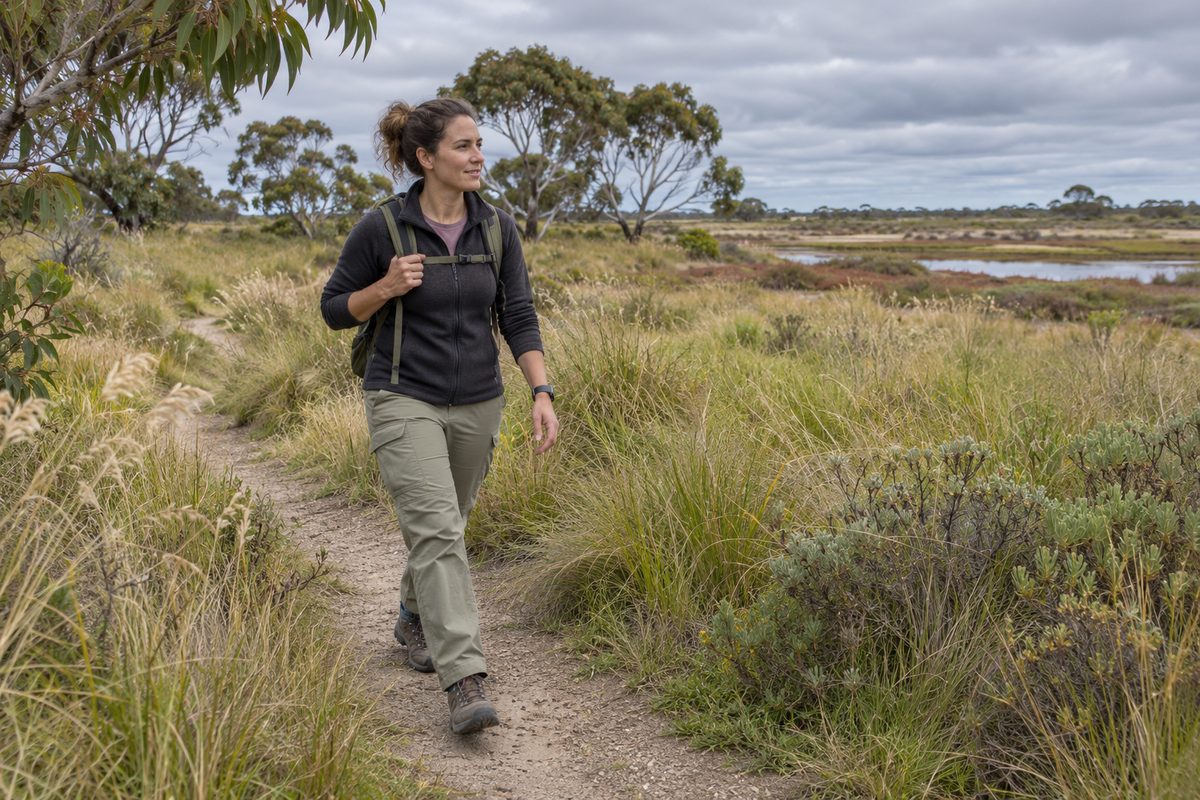
Point Cook Grassland Walking Routes
The best Point Cook grassland walking routes follow existing public paths through Point Cook Coastal Park and connect open grassland views with the edge of Port Phillip. Walkers should stay on marked tracks because much of the surrounding land supports sensitive plants, ground-dwelling animals and protected wetland areas. The main choice is between a short grassland stroll, a longer coast-and-grassland loop, or an extended walk towards the Cheetham Wetlands precinct.
These walks feel open and exposed. Trees are sparse, the horizon is broad and the weather can change the experience fast. A cool morning may bring clear views and active birds. A hot afternoon can turn the same route into a tiring walk with little shade. Good planning matters more here than it does on a suburban path.
Which part of Point Cook gives the best grassland walk?
Point Cook Coastal Park is the strongest starting point because it protects a mix of coastal grassland, saltmarsh, wetland and shoreline. Public paths let visitors see these areas without crossing fragile ground. The park also gives walkers a clear sense of how the western shore of Port Phillip changes from dry open land to tidal habitat.
The grassland is not a neat field or a formal garden. It can look dry and sparse, especially late in summer. That appearance is misleading. Native grasses, herbs, insects, reptiles and birds use small differences in soil, cover and moisture. A shallow dip that holds water after rain may support a different group of species from a nearby dry rise.
Start near the established visitor areas within the coastal park and use signed paths rather than informal wheel marks. Conditions and access arrangements can change after heavy rain, maintenance work or periods of high fire danger. Check current Parks Victoria information before leaving home.
What route works for a short grassland stroll?
A short walk should stay close to the main visitor area and follow the public Trail through open country before returning by the same path or a signed connecting track. Aim for 30 to 45 minutes rather than chasing a set distance. Wind, heat and uneven ground can make a short route feel longer than its map distance suggests.
This option suits walkers who want broad grassland views without committing to the exposed coastal sections. It also works well for families who need a simple return point. Turn back while everyone still feels comfortable. Waiting until a child is tired can make the exposed return leg hard, especially into a strong south-westerly wind.
Pause at the path edge and scan before moving on. Small birds often disappear against dry grass, while birds of prey may circle far above the ground. Do not step off the track for a closer photograph. A few metres of trampling can crush plants or disturb a nest that is almost impossible to see.
How can walkers combine grassland and coast?
A longer route can link the open grassland paths with the coastal edge inside Point Cook Coastal Park. Use signed connections to form a loop where current access permits, or return along the same track if the available map does not show a complete circuit. This avoids relying on an informal path that may end at a fence, drain or protected area.
The value of this route comes from the change in land, not from distance alone. The dry grassland gives way to salt-tolerant plants, sheltered water and the Marine coastal ecosystem along Port Phillip. Each zone supports different feeding and shelter needs. Looking back inland also shows why the open grassland should not be treated as empty space between the suburbs and the bay.
Allow about 60 to 90 minutes for an unhurried walk, depending on the selected public tracks. Add time if you plan to stop for birdwatching. The coastal leg may be cooler than the inland section, but it is often windier. Carry water even on a mild day and use sun protection in every season.
When does an extended wetland route make sense?
An extended walk towards Cheetham Wetlands suits people who are comfortable with a longer outing and want to understand the link between grassland, saltmarsh and shallow wetland basins. It should be planned from an official park map. Do not assume every visible maintenance road is open to walkers.
The wetland precinct is known for waterbirds and wide views over a human-shaped saltworks setting that has developed strong conservation value. A Bird hide can provide sheltered viewing where public access is allowed. An Observation tower may also appear on mapped walking options in the wider precinct. These features are destinations within a sensitive reserve, not permission to cross closed land between them.
This longer option overlaps with wetland walking rather than remaining a pure grassland route. Choose it when the ecological change is part of your goal. If your main interest is open plains, spend more time on the grassland paths and save the wetland section for another outing. The Point Cook Tideline local guide can help place nearby walks and local stops within a wider Point Cook visit.
How should you choose between an out-and-back walk and a loop?
An out-and-back walk is the safer choice when signs are unclear, weather is worsening or a member of the group has limited stamina. You see every turn on the outward leg, so the return is easy to judge. It also lets you shorten the outing without searching for a connecting path.
A loop gives more variety and reduces repeated scenery. It works best when the full route appears on a current official map and all junctions are signed. Do not create a loop by cutting across grassland. A line that looks like a track may be an animal path, an old vehicle mark or an access route reserved for park staff.
Distance alone should not decide the route. Consider shade, toilets, wind direction and the last safe point to turn around. A hypothetical four-kilometre loop in full sun can demand more effort than a longer suburban walk with trees and frequent exits. On exposed land, comfort depends on conditions as much as kilometres.
What will you notice in the grassland?
Look for changes in height, colour and density rather than expecting one uniform field. Native grassland plants respond to rain, soil and season. Introduced weeds may also be present. Visitors should avoid picking plants because identification can be difficult and even common-looking vegetation may form part of an animal's shelter.
The boundary between dry grass and wetter ground is often the most active place. Insects gather around flowering plants. Small birds move between cover and open feeding areas. Raptors may search the plains from above. Near the coast, waterbirds use mudflats and shallow water according to tides and food supply.
Bird migration adds another layer to the walk. Some shorebirds travel vast distances between breeding and feeding grounds. Their need to rest explains why Wildlife conservation rules may restrict access to certain areas. A bird that repeatedly flies away from approaching people spends energy it needs for feeding and migration.
Use binoculars rather than moving closer. Keep voices low near resting flocks and give animals room to choose their own path. Wildlife behaviour is more natural when people remain predictable and stay on the public track.
Why is staying on the track so important?
A marked route protects both the walker and the Habitat. Grass can hide holes, snakes, wet ground and sharp debris. It can also hide eggs, nests and young animals. Remaining on the track lowers these risks while limiting damage to plants.
Informal shortcuts cause wider harm than one set of footprints suggests. Once a faint line appears, other visitors may follow it. The line grows wider, water starts to flow along the bare soil and weeds can gain a foothold. One shortcut can become lasting damage.
Dogs must be managed according to the rules for the exact park area. Protected coastal reserves may prohibit dogs or apply strict controls because scent, barking and pursuit disturb wildlife. Check signs at the entrance rather than relying on rules from another Point Cook park.
Take all rubbish home. Food scraps are also rubbish. They can attract animals to paths and change their feeding habits. Leave rocks, feathers and shells where they are, as each may provide shelter or form part of the coastal system.
Which weather conditions suit these routes?
Cool, calm mornings usually provide the easiest walking. Low heat reduces sun stress, while softer light makes grassland details easier to see. Birds may also feed more actively during cooler parts of the day.
Avoid exposed routes during extreme heat, thunderstorms and severe fire weather. Grassland offers little protection from lightning or fast-moving fire. Strong wind can make the coastal edge uncomfortable and may push spray, dust or loose material across the path.
Rain changes the ground quickly. Firm soil can become slippery, while shallow low points may hold water. Do not walk around a puddle by widening the track through vegetation. If the marked route is flooded, turn back.
Season affects what visitors see. Spring may bring more plant growth and nesting activity. Summer often produces dry grass, sharp light and greater heat risk. Cooler months can mean softer ground and stronger winds. No single season guarantees wildlife sightings.
What should you carry on an exposed grassland walk?
Carry drinking water, sun protection and a charged phone. Wear enclosed shoes with enough grip for loose or damp surfaces. A light windproof layer is useful because conditions near Port Phillip can feel colder than nearby residential streets.
Bring a current route map in a form that does not depend on mobile reception. A downloaded map or printed copy can help at unsigned junctions. Binoculars add more value than heavy camera gear for most wildlife viewing because they let you observe from the path.
Pack insect repellent when mosquitoes are active. Check for ticks after walking through any permitted area where vegetation brushes clothing, though staying on open tracks reduces contact. Carry personal medicine and tell someone where you are going if you plan a longer solo walk.
How can families make the walk easier?
Choose a short out-and-back route with a fixed turnaround time. Tell children that the path protects hidden homes in the grass. This gives them a clear reason to stay on it without needing a long lesson about ecology.
Set small observation tasks. Ask walkers to spot two grass heights, find a bird without moving closer, or notice where dry ground meets wet ground. These activities slow the group and focus attention on the setting rather than the total distance.
Prams and mobility aids need a route check before the visit. Natural tracks may have loose gravel, mud, narrow sections or uneven edges. Accessible conditions can also change after rain. Confirm the surface and facilities through the park manager's latest information rather than assuming every mapped path is sealed.
How do you plan a route without damaging protected land?
Begin with an official Point Cook Coastal Park map and select one clear public path. Mark the start, turnaround point and nearest facilities. Check the forecast, park alerts and fire danger on the day of the walk.
Match the route to the least experienced person in the group. Add time for stops, then set a firm return time. If signs on site conflict with an older map, follow the signs. Gates and closures protect visitors, repair works or wildlife.
Keep the route simple on a first visit. A short grassland walk teaches you how the wind, surface and distances feel in this exposed setting. You can add a coastal connection or Cheetham Wetlands section on a later trip once you understand the area.
Choose one signed public route on the current park map, check the day's conditions, and stay on that track from start to finish.