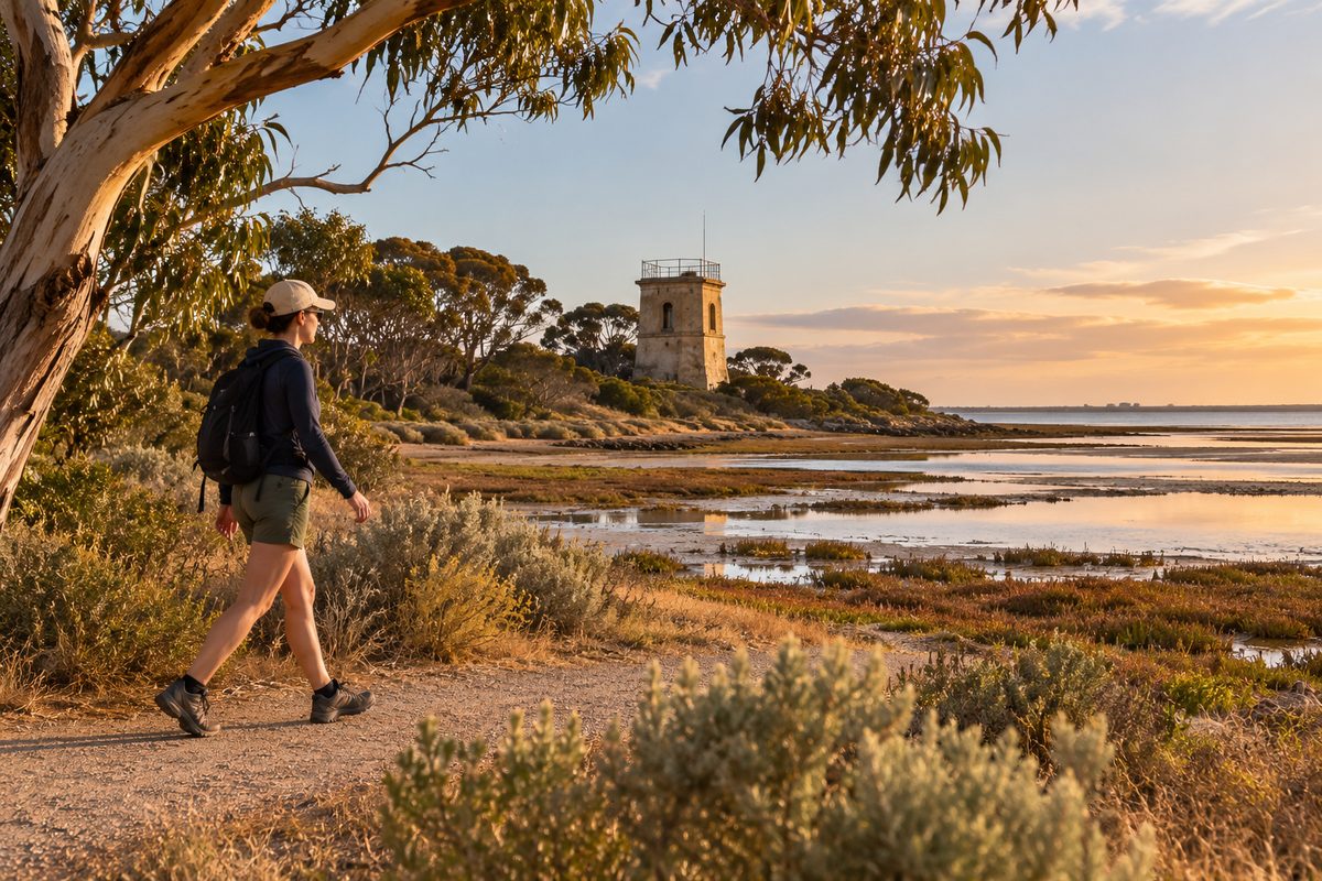
Point Cook Tower Walk
The Point Cook Tower Walk is a quiet coastal route from Point Cook Coastal Park to the Observation tower overlooking Cheetham Wetlands. It suits walkers who want open views, birdlife and a close look at the wetlands beside Port Phillip. The route is exposed, so mild weather, sun protection and enough water can make the difference between a pleasant walk and a tiring one.
This is a nature walk rather than a climb. The tower is the destination, but the changing coast is the main attraction. Saltmarsh, shallow ponds, low Vegetation and wide skies give the route a remote feel despite its place on the western edge of Melbourne.
Conditions can change after rain, strong wind or maintenance work. Check current Parks Victoria notices before leaving home. Allow extra time for birdwatching, photography and pauses along the Boardwalk.
Where does the walk begin?
The usual starting point is within Point Cook Coastal Park, near the coastal picnic and visitor area reached from Point Cook Homestead Road. Follow the signs towards Cheetham Wetlands and the tower rather than walking onto an unsigned management track.
Take a photo of the trail information at the start. The route is easy to follow when signs are clear, but the flat ground and repeated wetland ponds can look similar on the return trip. A saved offline map also helps if mobile reception becomes weak.
The walk passes through low, open country. Trees provide little shade once you leave the main visitor area. Toilets and drinking water should not be assumed along the wetland section, so use the facilities near the start when available and carry what you need.
The reserve may have opening hours or vehicle access conditions. Confirm them before a late visit. A walk that fits within daylight can still end after a car park gate closes if you spend longer than planned at the tower.
What is the route like underfoot?
The route uses formed paths and sections of Boardwalk across sensitive or damp ground. It is mostly flat, with no long hill climb. The tower has steps, so reaching its upper viewing level requires more mobility than walking the approach path.
Flat does not mean effortless. Wind can press against you for much of the route, while strong sun reflects from pale tracks and open water. After wet weather, unsealed sections may hold water or become soft. Closed shoes with grip are a better choice than smooth sandals.
Do not leave the marked route to shorten a bend. The surrounding soil may be soft, and a thin dry crust can cover mud. Walking off the path also damages salt-tolerant plants that recover slowly.
A comfortable visit often takes longer than the walking pace suggests. Someone moving steadily may cover the route with ease, while a birdwatcher could spend twice as long stopping at each pond. Plan by available daylight rather than by distance alone.
Why is the wetland setting worth seeing?
Cheetham Wetlands contains former saltworks ponds, channels and coastal saltmarsh. This mix creates feeding and resting areas for waterbirds. Changes in water depth and salt levels mean neighbouring ponds can support different birds at the same time.
The wetlands sit within the Port Phillip Bay (Western Shoreline) and Bellarine Peninsula Ramsar site. Ramsar listing recognises wetlands of international value. It does not turn the area into a theme park or guarantee wildlife at every visit. It supports careful management of a place used by resident birds and migratory species.
Some migratory shorebirds travel between Australia and breeding grounds in the Northern Hemisphere. The shallow edges of wetland ponds can provide places to feed and regain energy. Disturbance matters because repeated flights waste the energy birds need for survival and migration.
The Habitat may look bare at first. Look more closely at the pond margins. Small wading birds can blend into mud, saltmarsh and low plants. Ducks may rest farther from the path, while birds of prey can pass high above the open ground.
The site also records part of Melbourne's industrial history. Salt production changed water movement and created the pond system visible today. Nature has since made use of that altered setting. This is one reason the walk feels different from a beach track or a planted suburban reserve.
What can you see from the tower?
The Observation tower gives a higher view across the wetland cells, the coast and the flat western plain. From ground level, banks can hide water and birds. From above, the shape of the ponds and their links become easier to read.
Clear weather may reveal broad views towards Melbourne and across parts of Port Phillip. Haze, cloud and low sun can change what is visible. Binoculars add more value than a powerful phone zoom because many birds remain well away from the path.
The upper platform can feel much colder and windier than the trail below. Secure hats and loose items before climbing. Keep the stairs and landing clear so other visitors can move safely.
Use the tower as a viewing point rather than a promise of a dramatic lookout. Its appeal comes from scale. The higher position shows how water, embankments, coast and low Vegetation form one connected system.
How does the coast connect with the wetlands?
The walk sits beside Point Cooke Marine Sanctuary, a protected coastal area extending into Port Phillip. Point Cook and Point Cooke refer to related places, but the extra letter appears in the official sanctuary name.
As a Marine protected area, the sanctuary protects marine life and habitat within its boundary. Rocky reef, seagrass and soft seabed support fish and other sea life. Fishing and the removal of animals, plants or material are restricted within marine sanctuary boundaries. Check current Parks Victoria rules before any water-based activity.
The wetland and marine areas are managed as different environments, yet they meet along the same coast. Water movement, weather and animal movement connect them. A bird feeding near a wetland pond may later use the shore, while healthy coastal habitat supports life below the waterline.
Visitors should avoid treating the beach as a collection site. Leave shells, plants and marine life where they are. If exploring the shore, check the tide and keep clear of slippery rocks.
When is the best time to walk?
Choose a mild, dry day with light wind. Early morning often brings softer light, lower heat and more bird activity. Late afternoon can also be rewarding, but only when there is enough time to return before dark and before any gate closure.
Summer heat can build fast because the route has little shade. On hot or fire-danger days, choose another time. Winter can bring cold wind and wet ground. Spring and autumn often offer more comfortable walking weather, though exposed conditions remain possible in every season.
Tide times matter more if the visit includes the nearby shore. They matter less for the formed wetland path, where pond levels are shaped by drainage, rain and management as well as coastal conditions.
Rain does not always make the route unusable, but it can change the surface and increase mosquitoes. Repellent and long sleeves are useful when insects are active. Never enter a closed section, even when the track looks passable from the barrier.
What wildlife behaviour should visitors follow?
Stay on the marked track and keep noise low. Watch birds from a distance. If a bird stops feeding, gives repeated alarm calls or moves away as you approach, increase the distance.
Do not use recorded bird calls to draw wildlife closer. Repeated playback can disrupt feeding and breeding behaviour. A clear view is never worth pushing a bird from its resting place.
Dogs and other pets can disturb wildlife through scent, sound and movement. Follow the signed rules for Point Cook Coastal Park and Cheetham Wetlands. Do not assume a lead makes a restricted area suitable for a dog.
Carry all rubbish out. Food scraps can attract pests and change animal behaviour. Small items such as fishing line, elastic bands and plastic wrappers can also trap wildlife.
Snakes may occur in coastal grass and wetland Habitat during warmer weather. Remain on the path, watch where you step and give any snake a wide escape route. Never try to move or photograph one at close range.
What should you bring?
Carry water, sun protection and a charged phone. Add closed walking shoes, insect repellent and a windproof layer when conditions call for them. Binoculars are useful even for a casual visit because the reserve protects birds by keeping people away from key feeding areas.
A compact bird guide can help, but start with shape and behaviour rather than trying to name every species. Note whether a bird swims, probes mud, dives or walks along the pond edge. These clues narrow the options without forcing a guess.
For photography, use a lens that can capture wildlife from the path. Avoid stepping into Vegetation for a clearer angle. Morning and late-day light can bring out the shape of the pond banks, while midday light often creates glare from water.
There are few chances to buy supplies once the walk begins. Pack what you need before entering the reserve, then keep the load light enough to carry comfortably in wind and heat.
Is the route suitable for children or slower walkers?
The flat approach can suit families and walkers who prefer gentle terrain, but the exposure and total return effort still need thought. Children need close care near water, on the Boardwalk and around tower stairs.
Set a turnaround time before starting. This works better than making the tower a compulsory goal. A family can still enjoy wetland views and birdlife without completing the full route.
People with limited mobility should check current access details before visiting. Path surfaces, maintenance work and wet weather can affect ease of travel. The tower stairs may prevent access to the upper platform even when the approach path is manageable.
A useful pace is one that leaves enough energy for the return. The route comes back through the same exposed setting, so wind or rising heat may make the second half harder.
How can you plan the walk without missing key details?
- Check Parks Victoria alerts, reserve access rules and the weather forecast on the day.
- Confirm sunset and any vehicle gate closing time.
- Save the route offline and photograph the trail map at the start.
- Carry water, sun protection, repellent and a windproof layer.
- Stay on the marked path and observe wildlife from a distance.
- Turn back early if heat, wind, smoke, rain or track conditions become unsafe.
The walk can pair well with a broader visit to Point Cook's coast, but avoid packing too much into one outing. Time spent standing quietly often reveals more than rushing between stops. The Point Cook Tideline can help place the reserve within the wider local area.
Before setting out, check the current park alert, choose a mild day and carry enough water for the full return walk.