Point Cooke Marine Sanctuary Visitor Guide
Point Cooke Marine Sanctuary is best visited at low tide for shore exploration or during calm, clear conditions for swimming and snorkelling. This protected stretch of coast lies beside Point Cook Coastal Park on the western side of Port Phillip. Its basalt platforms, seagrass beds and shallow water support a wide range of Marine life close to Melbourne. Visitors can walk, watch wildlife, swim and explore, but must leave all animals, plants, shells and rocks where they find them.
The sanctuary is on Bunurong Country. Treating the coast with care protects both its living habitat and its cultural value. Conditions can change within hours, so a good visit starts with a weather forecast, a Tide check and a clear plan for what you want to see.
Where is the sanctuary and how do you reach it?
Point Cooke Marine Sanctuary sits off the Point Cook coast, about 20 kilometres southwest of central Melbourne. It covers roughly 290 hectares of coastal water and protects more than three kilometres of shoreline. The extra “e” in Point Cooke is part of the sanctuary’s official name, while the suburb is Point Cook.
Road access is through Point Cook Coastal Park. Follow the local signs to the coastal park and use a marked visitor car park. From there, walking tracks lead towards the beach, coastal viewpoints and the historic homestead area. Access arrangements and park gate hours can change, so check current Parks Victoria information before leaving home.
Public transport does not provide a simple door-to-shore trip. A visit by car or bicycle is usually easier. Cyclists should plan for exposed roads, wind and limited places to secure a bike near some access points.
The shore has natural rock, sand, mud and uneven ground. Some sections may be difficult for wheelchairs, prams or people with limited mobility. The firm paths and viewpoints within the coastal park can still provide views across Port Phillip without stepping onto the rock platform.
When should you plan your visit?
Choose your arrival time around the activity. Low tide exposes the Intertidal zone and gives careful walkers a chance to view pools, rock surfaces and small marine animals. A rising or high tide covers much of that habitat and may suit swimming when the water is calm.
Check the tide table for the nearest available Port Phillip station. The time printed for low tide does not mean every rock becomes safe or dry. Wind direction, air pressure and waves can alter the water level. Arrive before the predicted low so you can watch the water retreat and leave before it cuts off your return route.
Morning often brings lighter wind, though this is never guaranteed. Strong southerly weather can make the shore cold and rough. Hot days bring sun exposure with little shade near the water. Carry drinking water and use sun protection even when cloud covers the sky.
Allow more time than the map suggests. Moving over wet basalt is slow. A family may spend an hour covering a short part of the shore because children stop to examine each pool. That slower pace is useful, provided an adult keeps watching the water.
What can you see along the shore?
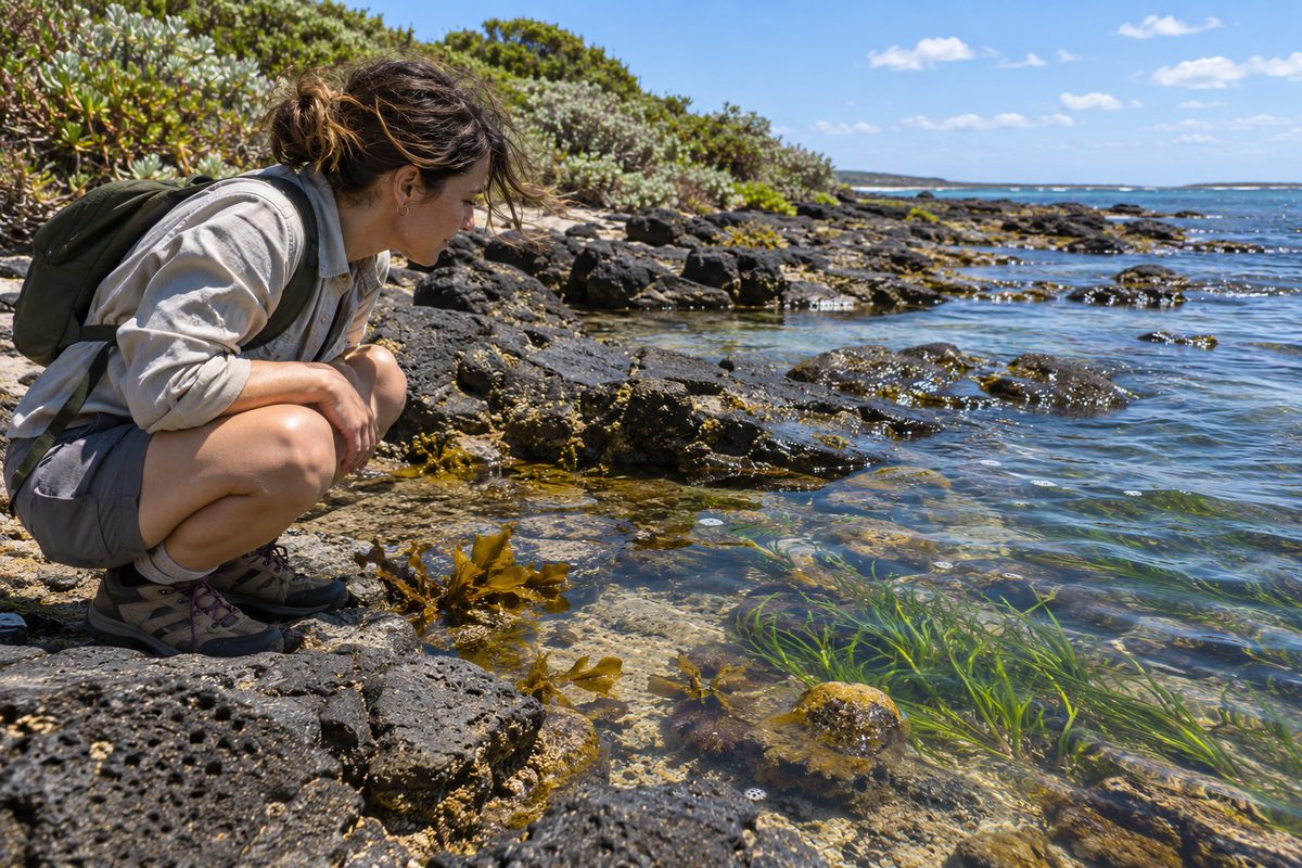
The sanctuary protects several connected habitats. Basalt rock platforms create cracks and pools. Seagrass grows in shallow water. Sandy and muddy areas shelter animals that remain hidden below the surface. Each habitat supports different Marine life.
At low tide, look for snails, limpets and small crabs without lifting or moving them. Sea stars, anemones and other soft-bodied animals may appear in pools. In the water, patient observers may notice small fish moving through seagrass or sheltering near rock edges. Birds also feed along the exposed coast, so give them room.
Point Cooke does not have a tropical Coral reef. Its hard reef is formed from basalt, a dark volcanic rock. This matters because visitors expecting bright coral may overlook the smaller life adapted to southern Port Phillip. A plain-looking pool can contain animals that survive major shifts in heat, salt and water cover each day.
Do not place animals in buckets for a closer look. Do not pull a snail from a rock or turn stones to search underneath. An animal may dry out, lose its shelter or become easy prey after a brief disturbance. Watch it where it lives and use a camera zoom if you want a closer view.
How should you explore the intertidal rocks safely?
Wear enclosed shoes with a firm grip. Wet algae can make basalt very slippery, while broken shells and sharp rock can cut bare feet. Step on solid, exposed surfaces where possible and avoid crushing growth around pool edges.
Keep your hands free for balance. Carry equipment in a small backpack rather than in loose bags. Children should remain within an adult’s reach near deep pools, channels and wave-washed ledges. The shore is not patrolled like a public swimming pool, and help may take time to arrive.
A clearly labelled hypothetical example shows why timing matters. A visitor walks far across the platform at low tide and focuses on taking photos. When the Tide turns, shallow channels fill behind them. The direct route back becomes slippery or submerged. The safer choice is to turn around early, before water reaches those channels.
Never rely on another group’s position as proof that an area is safe. They may know a different route, or they may have made a poor choice. Read the water yourself and return to land if waves increase, visibility falls or thunder approaches.
Can you swim, snorkel or paddle here?
Swimming and snorkelling can be rewarding in calm weather, but the site suits capable people who can assess open-water conditions. There may be no lifeguard present. Cold water, wind and submerged rock remain hazards even close to shore.
Snorkellers should enter from a clear, legal access point and stay away from breaking waves. A wetsuit can reduce cold stress and protect skin from sun, but it does not replace swimming skill. Use a brightly coloured surface marker where appropriate, stay with a partner and keep checking your distance from shore.
A snorkelling mask can make the seagrass and basalt habitat easier to see without touching it. Avoid standing on submerged plants or reef. Fin kicks can stir sediment, reduce visibility and disturb animals on the bottom.
Kayaks and paddleboards require suitable weather, proper safety equipment and a plan for wind. Offshore wind can push a small craft away from land faster than expected. Check Victorian boating rules before launching and wear an approved lifejacket for the craft and conditions.
What activities are banned inside the protected water?
The sanctuary is a Marine protected area where plants, animals and habitat are protected. Fishing is banned within its boundary. That ban covers line fishing, netting, spearfishing and attempts to catch bait. It also means visitors cannot collect Shellfish, take empty-looking shells or remove seaweed.
A shell may still house a small animal, while a truly empty shell can become shelter for another species. Rocks and drift material also form habitat. Leave them in place. The rule is simple: observe and photograph, but take nothing from the sanctuary.
Know where the boundary lies before bringing fishing gear anywhere near the coast. Do not guess from the appearance of the beach. Use official maps and signs, since the protected area is defined by law rather than by a fence in the water.
Report suspected illegal collection or Fishing through the contact method listed by Parks Victoria or the relevant Victorian fisheries authority. Note the location and time from a safe distance. Do not confront another person.
How does water quality affect a visit?
Water quality can decline after heavy rain. Stormwater carries litter, soil and microbes from streets and drains into waterways and Port Phillip. The water may look acceptable while still being unsuitable for swimming.
Check the latest official beach or bay water advice before entering. Avoid swimming near drains, discoloured water, strong smells or visible pollution. Waiting after heavy rain is a sound choice, especially for children and anyone with broken skin or a weak immune system.
Clear water does not prove that water quality is safe. In the same way, naturally cloudy water does not always mean pollution. Wind and fine sediment can reduce visibility. Official monitoring, recent weather and on-site signs provide better evidence than appearance alone.
If you see an algal bloom, dead fish, an oil-like film or a sewage spill, stay out and report it to the relevant authority. Keep pets and children away from affected water. Do not handle dead wildlife.
What should families and first-time visitors bring?
Pack for an exposed natural coast rather than a managed swimming centre. Useful items include drinking water, sun protection, enclosed shoes, a basic first-aid kit and warm clothing. Binoculars can improve wildlife viewing from land. A phone or camera in a waterproof case helps prevent damage near pools.
Food should remain sealed until you reach a suitable picnic place. Carry every wrapper and scrap out with you. Wildlife can swallow small pieces of plastic, while leftover food can change the behaviour of birds.
Toilets, drinking water and other facilities may be some distance from the exact section of shore you plan to explore. Check the park map before setting out. Do not assume mobile reception will solve a poor plan.
For young children, set one clear rule before reaching the rocks: stop when the adult stops. This is easier to follow than giving several new instructions after they become excited by a crab or fish. A short visit completed safely is better than pushing tired children across slippery ground.
How can you reduce your impact while you are there?
Use formed paths until you reach an approved shore access point. Walking through coastal plants widens tracks and weakens dunes. On the rock platform, avoid stepping into pools when you can view them from the edge.
Keep noise low near feeding or resting birds. If a bird moves away, calls repeatedly or changes direction because of you, increase the distance. Never chase wildlife for a photograph.
Follow current signs about dogs and other pets in Point Cook Coastal Park. Rules may vary by area because shorebirds and coastal habitat need protection. A lead does not make entry lawful where dogs are prohibited.
Do not leave fruit peel, fishing line or biodegradable packaging behind. Natural areas cannot process concentrated visitor waste without harm. If a bin is full, take the rubbish home.
What is the simplest plan for a good visit?
- Check the park access information, weather, Tide and official water quality advice.
- Choose low tide for rock-pool viewing or calm water for a planned swim.
- Wear enclosed shoes and carry water, sun protection and warm clothing.
- Use marked paths and keep children close on the shore.
- Leave all Marine life, Shellfish, plants, rocks and shells untouched.
- Finish before the weather or rising water limits your safe route back.
You can find more local planning ideas through Point Cook Tideline at https://thepointcooktideline.pages.dev/.
Actionable takeaway: Check the tide, weather and water advice on the morning of your visit, then choose one activity that fits those conditions.