Point Cook Beach Low Tide Walks
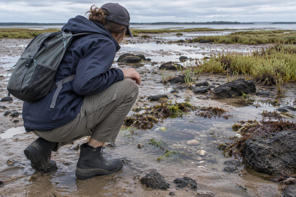
Point Cook beach low tide walks are best treated as short, timed explorations of the exposed shore rather than long walks along a smooth beach. Low water reveals rock, mud, shells and shallow pools beside Point Cook Coastal Park. The changing surface can be slow to cross, but it gives walkers a close view of a coast that remains hidden at higher tide.
The main idea is simple: the tide decides where you can walk. Check the tide forecast before leaving, arrive while the water is still falling and return before the route closes. This approach gives you more time to look around without racing the incoming water.
The coast sits on the western side of Port Phillip, where shallow water and low coastal land shape the walking experience. It does not feel like a broad surf beach. The appeal comes from the Intertidal zone, the coastal views and the chance to observe Marine life without removing or disturbing it.
What does low tide change at Point Cook Beach?
Low tide uncovers the strip of shore between the usual high and low water marks. This Intertidal zone may include exposed reef, soft sediment, seaweed and shallow water left in hollows. A section that looked covered and closed earlier can become open enough for careful exploration.
The exposed ground is rarely an easy walking track. Wet rock may be slick. Mud can hold a shoe. Loose shells can shift underfoot. Small channels can also remain filled after the nearby flats emerge. Low tide creates access, but it does not turn the whole shore into firm land.
These changes explain why two visits can feel very different. A walker arriving near high tide may have little room beyond the upper beach. Someone visiting close to low tide may see a wider shore with more texture and detail. Wind can also push water towards or away from the coast, so the visible waterline may not match the forecast to the minute.
When should you begin the walk?
Start during the falling tide, before the predicted low. This gives you time to explore while the route is opening. If you begin at the lowest point, the water may start returning soon after you leave the access area.
Use an official or established tide service and check the date, location and time zone. Tide times for nearby parts of Port Phillip can guide planning, but local water depth still responds to wind and weather. Treat the forecast as a planning tool rather than a promise about every pool or rock shelf.
A practical outing begins about one to two hours before low tide. Stay close enough to the upper shore that you can return without crossing deep water. Turn back when pools begin joining, channels start filling or dry rocks develop a wet edge. Do not wait until your outward path disappears.
Daylight matters as much as tide height. The uneven shore is harder to read in dim light. Choose a visit that keeps the walk and return well inside daylight hours. Check the weather too, since strong wind, heat or rain can make a short coastal walk tiring.
Where should a low tide walk start?
Use the signed public access in Point Cook Coastal Park and follow current park directions to the beach. Starting from a managed access point reduces the risk of crossing fragile vegetation, private land or restricted property.
RAAF Williams is a major neighbouring land use around Point Cook. Its presence means walkers must respect fences, warning signs and access limits. An exposed strip of coast is not permission to enter defence land or continue beyond a marked boundary. If a route meets a fence, closed area or official sign, turn around.
The safest plan is an out-and-back walk from the same public access. Follow the upper shore at first, then move onto exposed ground only where the surface and water depth are clear. Returning by the same line is easier than trying to create a loop across unfamiliar coastal land.
Do not assume the beach connects cleanly with Cheetham Wetlands. The wetlands are part of the wider coastal setting, but drains, protected habitat and access controls can separate areas that look close on a map. Visit them through their signed public routes rather than using the low tide shore as a shortcut.
How far can you walk before conditions become difficult?
Distance is a poor target on this coast. A kilometre over wet rock and soft sediment can take far longer than a kilometre on a path. Set a time limit instead. Spend half of the safe tide window moving away from the access point and keep the other half for the return.
Walkability changes every few metres. One patch may be firm and open. The next may contain mud, weed-covered stone or standing water. Families and slower walkers should choose a small area near the access point rather than chasing distance.
A useful low tide walk may cover only a short section of shore. The value comes from seeing how the water has shaped the ground. Ripples in sediment, shell fragments and small pools can hold attention without requiring a long route.
Never cross water when you cannot judge its depth or footing. A shallow-looking channel may have a soft base or a sharp drop at one edge. Go around it or return. Bare feet are a poor choice because broken shells, sharp rock and hidden debris can cause cuts.
What can you see without disturbing the shore?
A Tide pool can hold small snails, crabs, algae and other creatures adapted to changing water levels. Some animals hide beneath weed or in narrow cracks to avoid heat and birds. Others remain still enough to look like part of the rock.
Look closely before assuming a pool is empty. Shadows, bubbles and slight movement can reveal Marine life that is easy to miss. View animals from above and leave them where they are. Do not pour out water, move creatures into another pool or collect living shells.
Rocks provide shelter from sun and drying air. Lifting one can expose animals and eggs, while replacing it in the wrong position can crush them. The better method is to leave rocks untouched and use patient observation. A phone camera with zoom can record detail without handling wildlife.
Seaweed washed loose onto the shore may look like rubbish, but it can shelter small animals and feed the beach food web as it breaks down. Walk around larger deposits where possible. Do not pull attached plants from rock.
A simple hypothetical example shows why care matters. A child may find a crab beneath a stone and want to carry it to a clearer pool. Moving it can place the animal away from its shelter or expose it to fish and birds. Watching it in place gives the child a more accurate view of how it lives.
Why are the sanctuary rules part of the walk?
Point Cook Marine Sanctuary protects a section of the coast and nearshore waters. It is a Marine protected area, so visitors need to follow the current rules shown by Parks Victoria and signs at the site. Protection applies even when the tide pulls back and the seabed becomes easy to reach.
The safest rule for a casual walker is to take nothing from the shore. Leave animals, plants, rocks and shells in place. Fishing and collecting restrictions may apply within sanctuary boundaries, so anyone planning an activity beyond walking and photography should check the current regulations first.
Point Cook Marine Sanctuary also changes how the walk should be judged. A successful visit is not measured by what you bring home. It is measured by what you notice while leaving the habitat as you found it.
Keep dogs under control and follow the signs that apply to the beach and park area. Rules can vary by site and may change to protect wildlife. Check current park information before bringing a dog rather than assuming the same access applies across the whole coast.
Which hazards are easy to miss?
The incoming tide is the main moving hazard. Water can fill a channel behind a walker before it covers the outer flat. Keep checking the route back, even when the water near your feet looks unchanged.
Slips are more common where smooth rock carries a thin layer of algae. Test each step and avoid jumping between rocks. Shoes with enclosed toes and strong grip protect better than thongs. Move slowly enough to change direction without losing balance.
Soft mud creates a different risk. If the ground begins taking your foot below the sole, return to firmer terrain. Do not push towards a distant dry patch. It may be surrounded by deeper mud that is harder to cross on the way back.
Sun exposure can be strong because the open shore has little shade and reflected light comes off the water. Carry drinking water and use sun protection suited to the conditions. In cold weather, wind across Port Phillip can lower comfort fast, especially after shoes or clothing become wet.
Broken glass and fishing debris may occur on any urban coast. Scan the ground instead of watching only the water. Report dangerous waste through the relevant park or council channel if it cannot be handled safely.
What should you bring for a careful shore walk?
- Enclosed shoes with grip: Choose footwear that can handle wet rock, shells and shallow mud.
- A tide forecast: Save the low tide time before leaving in case mobile reception or battery power fails.
- A charged phone: Keep it dry and use it for navigation or emergency contact rather than relying on it to judge the ground.
- Water and sun protection: The exposed coast offers limited shade.
- A small rubbish bag: Carry your own waste out. Pick up other litter only when it is safe to handle.
- Binoculars or a camera: These make close observation possible without approaching wildlife.
Leave nets, buckets and collecting containers at home. They encourage handling that can damage small animals and conflict with sanctuary protections. A low tide walk works best as an observation trip.
How can families make the walk safer and more interesting?
Give children a clear boundary before reaching the water. A simple rule such as staying between an adult and the upper beach is easier to follow than repeated warnings about each pool. Adults should remain close enough to stop a fall on slick rock.
Turn the visit into a search based on features rather than collecting. Children can look for animal tracks, different shell shapes or the line where dry rock becomes wet. Photograph each find and compare the images later.
Choose a short session for young children. Twenty focused minutes near a Tide pool can provide more value than a long walk that ends with tired feet and a rising tide. Leave while everyone still has the energy to cross the uneven return route.
Prams and mobility aids are better suited to formed park paths than the exposed shore. The beach surface changes too much to promise reliable access. People who want a coastal view without rough footing should remain on signed paths and use established viewing areas.
How does this walk fit into a wider Point Cook visit?
Keep the shore walk as the tide-dependent part of the day. Other stops can occur before or after it, but the low tide window should control the schedule. This prevents a meal, drive or longer inland walk from delaying arrival until the water is already rising.
Point Cook Coastal Park provides the land-based setting, while the protected water and shore support the ecological focus of the visit. The nearby Cheetham Wetlands add a different habitat, but they deserve their own signed route and enough time for bird observation. Combining both areas works only when each is approached through public access.
For more local planning ideas, use the Point Cook Tideline as a starting point, then confirm tide, weather and park notices with official sources on the day. Local guides help shape an outing, while current notices decide what is open and safe.
What is the best plan for the day?
- Check the predicted low tide, daylight hours, weather and current park notices.
- Choose signed public access at Point Cook Coastal Park.
- Arrive while the tide is falling and set a firm return time.
- Stay on firm, visible ground and keep the return route in sight.
- Observe the Intertidal zone without lifting rocks, handling animals or collecting shells.
- Turn back as soon as water begins filling channels or footing becomes poor.
Actionable takeaway: choose a daylight low tide, arrive before it bottoms out and turn back at the first sign that water is reclaiming your route.